Maximize Vineyard Potential with Multispectral Data
Why Aerial Data is Essential for Your Vineyard?
Our Impact By the Numbers
Recommended Data Collection Frequency
* Critical Growth Stages: At least once during each key growth stage for targeted management.
* Seasonal Analysis: Minimum of once per season for overarching health assessment.
* Post-Weather Events: Additional surveys as needed to assess and mitigate weather impacts.
* Irrigation Monitoring: Bi-weekly to monthly during the growing season for water management.
* Disease and Pest Surveillance: Every 2-4 weeks during high-risk periods for early intervention.
Our Impact By the Numbers
Frequently Asked Question
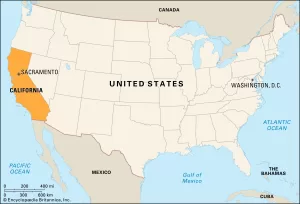
Our operations are intensified throughout California. Emphasizing that Southern California is closest to us as it is our current home!
But we also operate throughout the United States, especially for larger orders such as large commercial facilities (hotels, factories, large warehouse spaces).
Typically, once the shoot is completed, you can expect your edited photos and videos within 24-48h. However, for more complex projects the turnaround time might take up to 72h.
Weather can be unpredictable. If conditions are not suitable for flying, we’ll reschedule the operation to a more suitable day at no additional cost to you.
In most cases, as the property owner, you have the right to authorize drone flights over your property. However, we always ensure that our operations comply with local and federal regulations. If any additional permissions are needed, we’ll guide you through the process.
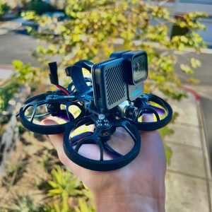
We have drones for both inside and outside use. Our indoor drones are small, light, and can fit in your hand. They’re great for showing the inside of buildings, which is becoming popular in the business of selling properties.
Our drone pilots are skilled and have the right licenses. They wear special goggles to see what the drone sees, making it easy to fly the drone through rooms without any problems.