Loading...

Property Showcase

Elevate Your Real Estate Listings with Roto Flight’s Property Showcase

Are you seeking a distinctive approach to showcase your real estate listings in Santa Barbara? Roto Flight introduces the Property Showcase service, revolutionizing property presentation. This service merges high-quality Santa Barbara Real Estate Photography with innovative FPV Drone Tours, offering a unique perspective to your listings.

The Excellence of Santa Barbara Real Estate Photography

Our Santa Barbara Real Estate Photographer team captures every detail of your property with precision and care. Additionally, our Santa Barbara Real Estate Videographer experts create engaging visual narratives that accentuate your property’s best features.

The Innovation of FPV Drone Tours

Roto Flight is proud to offer FPV Drone Tours. These tours provide an immersive experience, allowing viewers to explore properties dynamically. Our FPV Drone technology presents a comprehensive view of your property, exceeding the capabilities of traditional photography.

The Uniqueness of Indoor Drone Tours

Our Indoor Drone Tours uniquely present interior spaces. Therefore, they are an invaluable addition to Santa Barbara Property Photography, perfect for showcasing the layout and details of a home.

Comprehensive Real Estate Media Solutions

Roto Flight understands the need for a complete real estate media package. Consequently, we offer a suite of services, including Real Estate Drone Photography and Property Drone Photograph, essential for showcasing every angle of your property.

Partner with the Best in Santa Barbara

As a top Santa Barbara Photographer, Roto Flight commits to delivering superior real estate media solutions. Our services, tailored to each property’s unique needs, ensure that your listings not only attract attention but also captivate potential buyers.

In conclusion, Roto Flight’s Property Showcase is the ultimate solution for enhancing real estate listings in Santa Barbara. Our comprehensive range of services, from Santa Barbara Real Estate Photography to FPV Drone Tours, ensures captivating presentation of your property.

Revolutionizing Real Estate: The Power of Aerial Photography

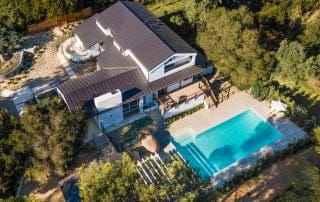
Embrace the future of property showcasing with Roto Flight, where Aerial Photography takes center stage. Our service portfolio stars Drone Real Estate Videos that narrate the unique story of each property. Gain a new perspective with our Property Aerial View, which offers a comprehensive visual narrative of your estate's layout and integration with the surrounding environment. Real Estate Drone Photography is not just about capturing images;

Frequently Asked Question

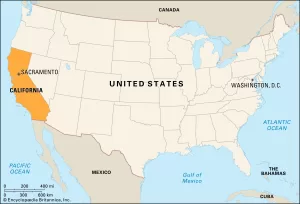
Our operations are intensified throughout California. Emphasizing that Southern California is closest to us as it is our current home!

But we also operate throughout the United States, especially for larger orders such as large commercial facilities (hotels, factories, large warehouse spaces).

Typically, once the shoot is completed, you can expect your edited photos and videos within 24-48h. However, for more complex projects the turnaround time might take up to 72h.

Weather can be unpredictable. If conditions are not suitable for flying, we’ll reschedule the operation to a more suitable day at no additional cost to you.

In most cases, as the property owner, you have the right to authorize drone flights over your property. However, we always ensure that our operations comply with local and federal regulations. If any additional permissions are needed, we’ll guide you through the process.

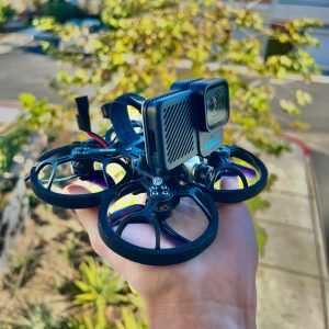
We have drones for both inside and outside use. Our indoor drones are small, light, and can fit in your hand. They’re great for showing the inside of buildings, which is becoming popular in the business of selling properties.

Our drone pilots are skilled and have the right licenses. They wear special goggles to see what the drone sees, making it easy to fly the drone through rooms without any problems.

EXPLORE OTHER SERVICES

Aerial view of housing development and construction in a newly established suburb

Industrial Data Collection

AgricultureEnergyConstructionReal EstateForestryTransportationEnvironmental MonitoringInsuranceUtilitiesSearch and RescueArchaeologyTourism

A person performing precision drone operations, riding a mountain bike in the air.

Precision DRONE Operations

BusinessesOffice Spaces RestaurantsHotels / SpasWarehousesFront StoresMuseumsVenuesHealthcare facilitiesConcert hallsGolf CoursesundefinedCinema

Go to Top